|
The Begwyns
An overall look at this large area of common land and its place in local history |
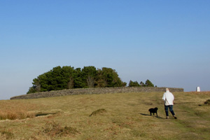
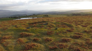
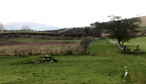
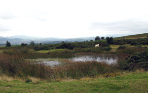
 Heading East across the Begwyns with the Roundabout at the top of the picture - B Bowker - 20/04/2014 |
| Introduction
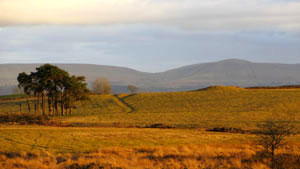
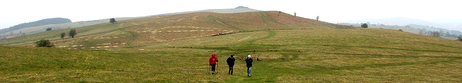
The Begwyns is a large upland area and encompasses
a wild and rolling landscape of common land situated north of
Ffynnon-Gynydd and south of Painscastle. It rises to 415 m at
the Begwyns Round Barrow ( contained in the summit Roundabout
) and falls away to a low point of some 270 m to the NW. The whole
area of 1292.98 acres had been owned for a long period by the
Maesllwch Estate before being gifted to the National Trust by
Major G. W. F. De Winton on the 7th July 1992. Since this time
the National Trust have been overseeing and surveying the area
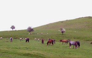
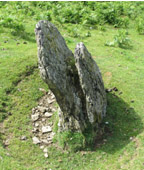
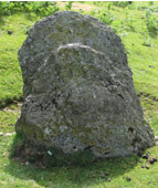
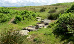
on a continuing basis. The triangulation point close by was adopted in January 1997 by the Beagley family of Cornhill and has been maintained by them admirably since that time. Common Rights The farms surrounding the Begwyns possess varying common rights depending on their deeds. These are in the main pasturage, estovers and common in the soil and the farmers themselves have mutually exercised and managed these rights over a long period prior to ownership by the National Trust. At a practicing level the rights refer to the grazing of sheep, ponies and cattle, along with the cutting and gathering of bracken for winter bedding on the surrounding farms. There has also been selective quarrying of rock and the shales over a long period, some of this being used for building purposes and some to improve the various trackways where necessary. It is worth noting that both the farmers and the National Trust have been and are developing a working relationship regarding the management and preservation of the area. Settlement There is abundant physical evidence that the Begwyns have been occupied by man during prehistoric times and some indications for the medieval period, although at present nothing has been discovered to suggest an occupation by the Romans. There is also post medieval evidence of agricultural and wartime activities, latterday quarrying and the creation / improvement of access tracks and footpaths. Prehistoric Settlement Within the Roundabout lies the Begwyns Round Cairn, probably of the Bronze Age and a burial mounds of some 11m in diameter which has been much abused over the years by grazing animals, human traffic and tree planting. It is now a Scheduled Ancient Monument (S.A.M.) with a protected area of 22m in diameter. Other S.A.M.'s of note are as follows : - The Maesgwyn Round Barrow - GR 164 436 This is a grass covered barrow of some 19.5m in diameter and 1.6m high. The protected area is 26m in diameter The Bailey Bedw Ring Cairn - GR 165 442 This is a well constructed ring and possibly a burial cairn. It is 7m across and encircled by a stony bank up to 3m wide and 1m high. The protected area is a circle of 15m radius. The Begwyns Standing Stone - GR 153 450 ( Possible Prehistoric standing stone ) This is a large split stone of just over a metre high and a metre wide. It is nearly 0.5m thick and has a 8m diameter protected area. Along with 11 other lesser sites the four above are considered to be of the Bronze Age and all but one, the Maesgwyn Round Cairn, are located in the northern half of the Begwyns. The reason(s) for this are not fully understood and could be topographical, geological or to do with the climate at the time, which was decidedly more temperate. During the surveying of these sites a number of flint artefacts were found, these being four flint scrapers and three small fragments of flake debris. The size and knapping on the scrappers would suggest an early Bronze Age date Medieval Settlement This site is an extensive one with several earth
platforms. There are supporting stone foundations, of rectangular
long huts and a number of small attached enclosures. There is
also a series of larger enclosures defined by earth banks. Post Medieval to Modern The common rights have been in use since medieval times on the
Begwyns and during this period there have been improvements to
existing roads and trackways ( a particular example being the
road from Ffynnon-Gynydd over to Painscastle, once a well used
ancient trackway - as witnessed by the very high roadside hedges
- and now a fully metalled 'C' class road. Wartime Activity Some temporary but important events occurred during
World War Two when the War Agricultural Executive Committees implemented
farming changes for a second time. The effect of the "War Ags"
was to increase the productive land in the UK by over 1.5 million
acres between 1939 and the early 1940's and this included large
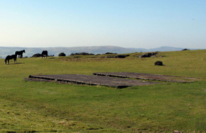
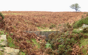
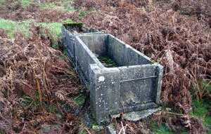
areas of the commons of Ffynnon-Gynydd and the Begwyns. Approaching from the west the first of these can be found at GR 139 435 and is the loading ramp mentioned above. The second can be found at GR 143 435. These are the two concrete bases; all that is left of the nissen style huts. The third is the small dam and related water troughs which were constructed for the benefit of the cattle and can be found in the area of GR 149 436. The water was piped from the dam to the troughs to provide a reliable and safe supply. The fourth was a post-war event and is known locally
as 'The Bomb Hole' . During the war ammunition was safely stored
in a variety of depots ( A large one was created at Gwernyfed )
and these became redundant with the advent of peace. After a few
minor and trial explosions it was decided to dispense with the remaining
ammunition in one fell swoop and the Begwyns was the favoured and
chosen site. In due course the ammunition was sited at a safe distance
from the road at GR 178 443 and the demolition team at a even safer
distance in the ditch to the southwest. The bomb-blast was successful
but ruptured the bed-rock below, allowing a spring-line to create
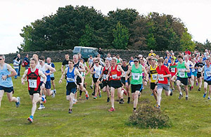
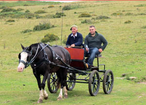
a small lake which has remained largely full since that time. Recreation The prime recreational activity on the Begwyns
both past and present has always been walking in its various forms
and the foremost of these is walking for exercise by individuals
- sometimes with their dogs. To a lesser degree there have been
organised groups at an archaeological, historical and ecological
level and since the mid 20th century the Outdoor Education Centres
have used the Begwyns for hiking, pony trekking, map reading, cross
country skiing, mountain biking and also camping. These activities
have also been pursued at a personal level by numerous hardy individuals.
- click here
for one example
B Bowker
Sources Wales, A Physical, Historical and Regional Geography. Edited by E. G. Bowen, M. A. F.S.A. National Trust archival material
and reports. Mr Paul Greenow
|
|